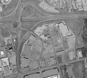
Orthophoto (Ortho Rectified Aerial Photography)
An aerial photograph contains distortion, caused by terrain undulations and camera characteristics, which results in an inconsistent scale across the image. With the advent of faster computer processors and state of the art software, Ortho rectified aerial photographs are becoming more readily used for measurement and spatial analyses.
Ortho rectified aerial photographs can either be produced as grayscale or colour raster images that have had geometric correction applied. This correction is more commonly referred to as rectification. To achieve this process an aerial photograph must first be scanned using a high quality geometric precision scanner. An important decision that should be made in the ortho rectification process is the selection of an appropriate pixel size. Each digital image is a representation of the ground surface made up of individual pixels, with each pixel consisting of 1 byte of information representing a specific dimension of ground information. Depending on the scale of the final image, common resolutions or pixel sizes are 10, 12.5, or 15 microns.
 The distortion in aerial photographs is removed by transforming the effects of the terrain, removing the perspective projection or characteristics of the camera, and by fitting the image to a particular map projection. This process creates an “image” that has a uniform scale, a known accuracy and is typically geo-referenced.
Once rectification has been performed, ortho rectified aerial photographs can be used as a map whereas conventional aerial photographs cannot. A rectified image can also be superimposed under existing vector mapping or be viewed by raster viewing software.
Digital ortho images can be deployed for various studies such as the development of land information systems, land use issues such as planning, zoning, transportation, and agriculture.