GPS Surveys
What is GPS?
GPS (Global Positioning System) is a cluster of 24 American satellites that orbit the earth in fixed orbits. Initially GPS was used strictly for American military purposes. Subsequently the American government has allowed the GPS system to be available to commercial users.
The Global Positioning System enables anyone with a GPS survey grade receiver to locate their position precisely on the globe by measuring to four or more satellites.
The latitude, longitude and elevation of the receiver will be accurately displayed to within a few centimeters depending on occupancy time, number of receivers used and number of GPS satellites visible to the receivers.
Alongside the GPS satellites are the Russian positioning satellites (GLONASS) and within a few years the European positioning satellites (GALILEO) will also be operational.
All of these positioning systems collectively are referred to as The Global Navigation Satellite System (GNSS).
What is GPS used for?
GPS has many commercial uses such as address location in map form where absolute accuracy is not an issue (2 to 3 meter accuracy is fine to locate a road intersection).
Typical users would be fire trucks, ambulance, taxis, police, and the average driver if they want to find their way around any number of cities from inside their cars.
It can also be used to track the location of fleet vehicles or any vehicle that has been stolen.
 At Northway/Photomap/Remote Sensing Ltd., GPS is used for the accurate positioning of ground features (2 to 3 centimetres).
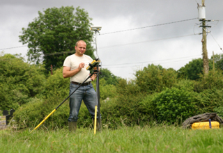
The Survey system we generally use is referred to as RTK GPS (Real Time Kinematic GPS) and involves the use of two or more GPS receivers – a Base and Rover.
A Base Station receiver is set up and referenced to a Published Horizontal Control Monument that has a known elevation.
The Base Station Receiver then calculates and sends corrections to the Rover receiver typically over a radio modem and the features collected by the Rover would subsequently not need to be post processed.
Features could be targeted control points or photo identifiable points used in photogrammetry such as manholes, catch basins, fire hydrants, utility poles, concrete sidewalk corners, fence corners etc. that would be visible on a 24cm X 24cm aerial photo.
They could also be golf course features like sprinkler heads or yardage markers or a grid of elevation points (DEM) on the fairways or greens.
Other uses for GPS are profiles along the centerline of a road or road cross-sections.
GPS can also be used to measure accurate water depths in shallow bodies of water
Who uses GPS Survey data?
Land Surveyors, Mapping companies, GIS departments, Airports, Engineers, Developers and Planners would be the main users of GPS Survey data.
Surveyed points would be typically referenced to a UTM or MTM grid projection (Eastings and Northings) and also referenced vertically to a sea level based benchmark (CGVD28).
These points could then be inserted and referenced into any digital drawing with the same projection.
Benefits to the Client
GPS eliminates the time consuming angle and distance traversing method with instant error free X and Y positioning wherever you want to read a point. (No more closure errors).
It also eliminates the long leveling loops and leveling errors by giving instant vertical readings at any location you wish to read.
Jobs that used to take weeks to do by a crew of four can now be done in days using one or two persons so the costs to do a project are greatly reduced while the accuracy is still maintained.