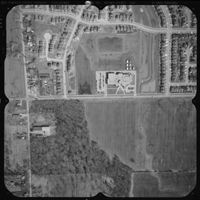
Historical Aerial Photography
On site, Northway/Photomap/Remote Sensing Ltd. maintains a library of over 1.5 million aerial negatives from 1961 to the present. Off site our library extends to back to 1950, and some into the 1940’s. The scale of photography ranges from 1:2500 to 1:50000. All of our photography has been acquired with a minimum 60% forward overlap and 30% lateral overlap to satisfy a variety of services from Stereo Interpretation to Topographic Mapping, Orthophoto production and Aerial Anaglyphs.
 The bulk of our photo coverage is in Ontario, but many other areas are also available. Our relationship with others in the mapping industry and with various government agencies enables us to locate and acquire historical aerial photography beyond our own library. Our photography can be mosaicked, enlarged or reduced to produce report prints, transparencies and wall displays.
We also offer a historical aerial photography review service for providing expert advice on features visible in the photography. There are nine common elements that are used to interpret aerial photography, and the most important one is the stereo perspective. This is accomplished by using specialized computer hardware and software which allows the user to view the area of concern in 3 dimensions. Using the stereo perspective allows for the recognition of many features that may not be visible without the use of this element. Our historical aerial photography reports are completed by an Ontario Land Surveyor, specializing in photogrammetry, and in most cases recognized by the courts as an expert witness when required. We have worked with many Law Firms over the years for criminal and civil cases.
All Imagery products are produced on-site and can be provided in hard copy and digital formats. Delivery can be by post, courier, e-mail or via FTP Internet transfer.
Our aerial photography is also available for review at our office. This is a common exercise used by Environmentalists to assist with their Phase 1 Audits or lawyers in preparation of case material.
Our photography has been used in Text Books, Newspapers, Lobby Displays, Calendars, OMB Hearings, Legal Disputes, Real Estate Marketing, Reports, Websites, Company Advertisements and many other visual products.
New Aerial Photography
New aerial photography is acquired on a yearly basis for client projects and to renew our library. Both vertical and oblique aerial photography, can be scheduled through our office. We can coordinate all the details from the design phase through to the final product. These aerial photography missions can be completed using multi-engine fixed wing aircraft for large areas, or drone aircraft for smaller areas.
All of our aerial photography is taken with GNSS (global navigation satellite system) and IMU (inertial movement unit) which allows for the capture of the angles (roll, tilt, and crab) of the aircraft, and the latitude, longitude and elevation of the aircraft during the exposure of the photograph. With this information, the newly captured photographs can be used for many uses immediately after the mission is complete.